Craigmillar, Rosslyn, Waterloo, Hadrian
We had an idea where were going next, Lumley Castle; a reportedly haunted castle and we were staying the night in it. Before then, though I was still itching to see Rosslyn Chapel (hidden Templar treasure awaited). We we also going see one of the forts on Hardian’s Wall. Little did we know that we would see the ruins of Craigmillar’s castle nor a monument to Waterloo.
We had not been on the road long, heading to Rosslyn when we saw signs for Craigmillar Castle. Our route took us directly there.
Craigmillar Castle
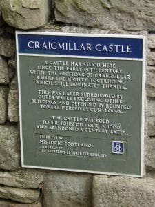 Craigmillar Castle is a ruined medieval castle in Edinburgh, Scotland. It is three miles (4.8 km) south-east of the city centre, on a low hill to the south of the modern suburb of Craigmillar. The Preston family of Craigmillar, the local feudal barons, began building the castle in the late 14th century and building works continued through the 15th and 16th centuries. In 1660 the castle was sold to Sir John Gilmour, Lord President of the Court of Session, who made further alterations. The Gilmours left Craigmillar in the 18th century, and the castle fell into ruin. It is now in the care of Historic Environment Scotland as a scheduled monument
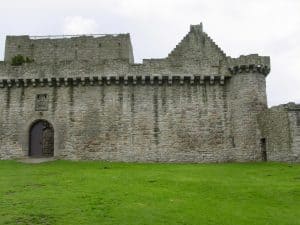
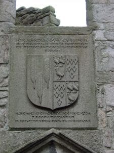
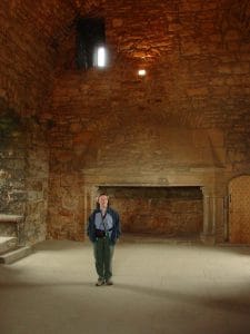
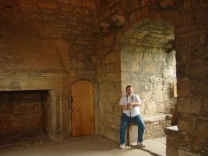
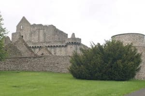
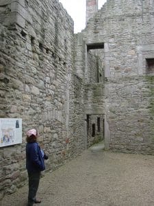
It was completely open to walk around and explore and we did. We walked the towers with their circular staircases, sat in the dining room, even found the wash closet complete with the “drain” to the outside. One could almost hear the history.
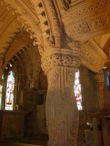 Next, we made it Rosslyn Chapel. This is what I had been waiting for now several days. Though not on our initial itinerary, it was not out of the way to get there either. I wanted to see the “apprentice pillar”, the “rose line” and other features the Dan Brown talked about in “The DaVinci Code”. I wanted to feel the mystery of looking at symbols whose meaning has long since been forgotten (or has it)? We parked and I was eager to explore.
Rosslyn Chapel
Rosslyn Chapel, formally known as the Collegiate Chapel of St Matthew, is a 15th-century chapel located in the village of Roslin, Midlothian, Scotland.
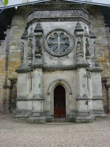 Rosslyn Chapel was founded on a small hill above Roslin Glen as a Catholic collegiate church (with between four and six ordained canons and two boy choristers) in the mid-15th century. The chapel was founded by William Sinclair, 1st Earl of Caithness of the Scoto-Norman Sinclair family. Rosslyn Chapel is the third Sinclair place of worship at Roslin, the first being in Roslin Castle and the second (whose crumbling buttresses can still be seen today) in what is now Roslin Cemetery.
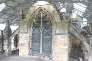
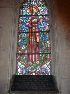
After some time, we set off. No, I had not solved the mystery of the Holy Grail, but I did find it fascinating. We drove for a while while Teresa navigated and Daryl slept (rested his eyes).
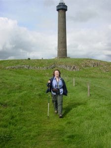
Soon, she had us near Ancrum. There were some geocaches in the area that she wanted to do and on of them had to be near that tower looming on the hill. Daryl had not minded geocaching with us, but he decided the hill was too much and stayed at the car. We, being the more adventurous souls, set out up the hill and discovered Waterloo Monument.
Waterloo Monument
The Waterloo Monument near Ancrum in the Scottish Borders is a 150-foot tower, built between 1817 and 1824 to commemorate the Battle of Waterloo. It was designed by the architect Archibald Elliot, after the original monument designed by William Burn collapsed.
The monument stands on Peniel Heugh, OS ref: NT 653263, a hill between Ancrum and Nisbet, Roxburghshire. Although technically on private land, walkers may park at the Harestanes Visitor Centre and then follow the marked walk to the top of the hill. The tower is not open to the public, although a key to the monument can be borrowed at a small cost from the Lothian Estates Office in nearby Bonjedward. Inside the monument is a spiral staircase leading to the balcony which encircles the top of the tower.
We spent a good hour, both exploring and searching for a cache (which was a “No-Find” for us). We did not want to be too long, not with Daryl waiting at the car. He worries about us sometimes. When we got back, he was just getting out of the car. He said he used the time to nap.
Next on the map was Hadrian’s wall, or more specifically, the ruins of a Roman fort along the wall.
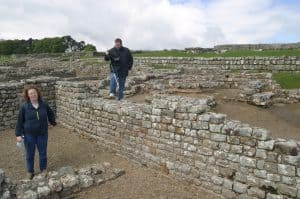
We turned into a parking lot and made our way up to the fort. Many of the walls had been torn down and the stones used for homes and fences and the like. What was left were more like foundations. Still, it was fascinating to think that the Roman Empire stretched this far and the Roman soldiers lived (and died) here.
Hadrian’s Wall
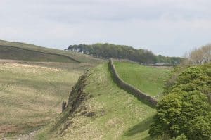 Hadrian’s Wall (Latin: Vallum Aelium), also called the Roman Wall, Picts’ Wall, or Vallum Hadriani in Latin, was a defensive fortification in the Roman province of Britannia, begun in AD 122 in the reign of the emperor Hadrian. It ran from the banks of the River Tyne near the North Sea to the Solway Firth on the Irish Sea, and was the northern limit of the Roman Empire, immediately north of which were the lands of the northern Ancient Britons, including the Picts.
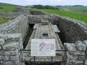 It had a stone base and a stone wall. There were milecastles with two turrets in between. There was a fort about every five Roman miles. From north to south, the wall comprised a ditch, wall, military way and vallum, another ditch with adjoining mounds. It is thought the milecastles were staffed with static garrisons, whereas the forts had fighting garrisons of infantry and cavalry. In addition to the wall’s defensive military role, its gates may have been customs posts.
 A significant portion of the wall still stands and can be followed on foot along the adjoining Hadrian’s Wall Path. The largest Roman artifact anywhere, it runs a total of 73 miles (117.5 kilometres) in northern England. Regarded as a British cultural icon, Hadrian’s Wall is one of Britain’s major ancient tourist attractions.
It is a common misconception that Hadrian’s Wall marks the boundary between England and Scotland. In fact Hadrian’s Wall lies entirely within England and has never formed the Anglo-Scottish border. While it is less than 0.6 miles (1.0 km) south of the border with Scotland in the west at Bowness-on-Solway, in the east it is as much as 68 miles (109 km) away.
It had been a full day. We were all tired and wanted to get to Lumley Castle in time for dinner and get a good nights sleep.

