 Growing up, there was a TV show called the “Streets of San Fransisco”. TV and movie sets/locations have always fascinated me. Add to that the diversity and culture that is San Fransisco and this was where we decided to venture to this year. The Street cars, Alcatraz, China Town, the Golden Gate Bridge, the Presidio and so much more.
San Francisco, CA
First, we needed to find place to stay. Downtown was too expensive, but there were hotels in other districts like Russia Hill or China town that fit out budget. After some research, we decided to stay in Japan town.
Japan town
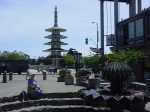
Japan town was centrally located, near Cathedral Hill. The bus routes were within walking distance as were many of the sites. We decided to fly in and not rent a car, relying on taxi’s and public transportation. We booked at the Hotel Kabuki. After we arrived (it was late in the evening as it took most of the day to fly), we explored the area, including the Pagoda and fountains before retiring.
Japantown (日本町 Nihonmachi) (also known as J-Town or historically as Japanese Town, or “Nihonmachi” (“Japan town”, in Japanese)) is a neighborhood in the Western Addition district of San Francisco, California.
Japan town comprises about six city blocks, and it’s considered one of San Francisco’s largest and oldest ethnic enclave in the United States.
Its focal point is the Japan Center, which opened in 1968, and is the site of three Japanese-oriented shopping centers. The San Francisco Peace Pagoda, also at the Japan Center, is a five-tiered concrete stupa designed by Japanese architect Yoshiro Taniguchi and presented to San Francisco by the people of Osaka, Japan.
Built and settled as part of the Western Addition neighborhood in the 19th and early 20th century, Japanese immigrants began moving into the area following the 1906 earthquake. By World War II, the neighborhood was one of the largest such enclaves of Japanese outside Japan, as it took an appearance similar to the Ginza district in Tokyo. (source)
China Town
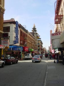
The next morning, we grabbed a quick nite to eat and then hopped a bus and went downtown. We wanted to explore some and it seemed like a good place to start. We got off in China town. It was still early, though traffic was heavy. The shops were filled with trinkets, chachkies, and even some expensive souvenirs and antiques. Most of the restaurants seemed fancier than the carry-out places that cover the US.
After walking around and finding one of the original “fortune cookie” factories. Many claim to be the first, and no one knows for sure.
A fortune cookie is a crisp and sugary cookie usually made from flour, sugar, vanilla, and sesame seed oil with a piece of paper inside, a “fortune”, on which is an aphorism, or a vague prophecy. The message inside may also include a Chinese phrase with translation and/or a list of lucky numbers used by some as lottery numbers; since relatively few distinct messages are printed, in the recorded case where winning numbers happened to be printed, the lottery had an unexpectedly high number of winners sharing a prize.
Fortune cookies are often served as a dessert in Chinese restaurants in the United States and other Western countries, but are not a tradition in China. The exact origin of fortune cookies is unclear, though various immigrant groups in California claim to have popularized them in the early 20th century. They most likely originated from cookies made by Japanese immigrants to the United States in the late 19th or early 20th century. The Japanese version did not have the Chinese lucky numbers and was eaten with tea. (source)
Street Cars
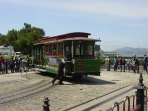
Street cars in San Francisco are an historic landmark. We hoped on one just for the ride. We did not care where it was taking us, just to be on one was a joy in itself.
We hopped off in a park that had several geocaches and spent the afternoon hunting them.
We had a friend in the Bay area and we had decided to meet him and his girlfriend for an early dinner. We walked to the Fisherman’s Wharf. We had known and worked with him before on some geocaching contests and marketing. We decided to have dinner at the Hard Rock on Pier 39. We enjoyed the evening getting to know them better. Finally, we said our good-byes and headed back to the hotel.
Lombard St
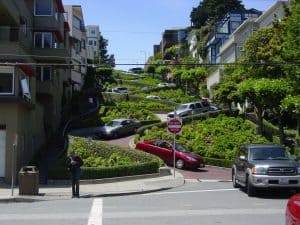
The next morning was a full day of exploring. After a traditional breakfast from one of the local Japanese restaurants, we used the bus to get us to one street car. Its route took up to the top of Lombard St. We hopped off there and walked down the most croakiest road in the world.
Lombard Street is an east–west street in San Francisco, California that is famous for a steep, one-block section with eight hairpin turns. Stretching from The Presidio east to The Embarcadero (with a gap on Telegraph Hill), most of the street’s western segment is a major thoroughfare designated as part of U.S. Route 101. The famous one-block section, claimed to be “the crookedest street in the world”, is located along the eastern segment in the Russian Hill neighborhood. It is a major tourist attraction, receiving around two million visitors per year and up to 17,000 per day on busy summer weekends, as of 2015.(Source)
From there, we walked to Coit Tower, picking off a few geocache’s along the way. The tower, a landmark seen in many TV and movies, has some unique artwork inside and a stunning view from the top.
We headed to the old north neighborhood and found a nice Italian restaurant for lunch.
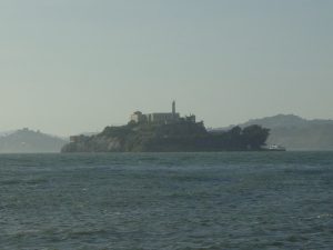 We walked again to Pier 39. There was a tall sailing ship open for tours and we decided to learn more about shipping. We had wanted to go to Alcatraz, but like monuments in DC, the tickets go early and fast. So we settled for the view.
Alcatraz Island is located in San Francisco Bay, 1.25 miles (2.01 km) offshore from San Francisco, California, United States. The small island was developed with facilities for a lighthouse, a military fortification, a military prison (1828), and a federal prison from 1934 until 1963. In 1972, Alcatraz became part of a national recreation area and received designation as a National Historic Landmark in 1986. (source)
Pier 39 and Fisherman’s Wharf
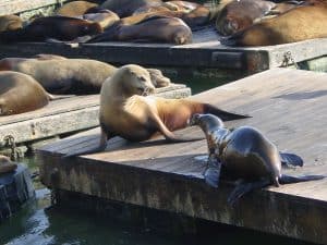 Of course, the sounds of the wharf including the barking of the Sea lions and there were hundreds sunning themselves in the cool San Francisco sun. There is a quote “The coldest winter I ever saw was the summer I spent in San Francisco.” and has often been attributed to Mark Twain. However, that is not ever been proven, though he did say something similar about Paris, France (source). That being said, pack for cooler weather; you will thank me.
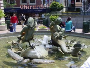 Going to San Francisco and not seeing Ghiradelli Square is just wrong. There were no tours, but the shop was open and we indulged in some sweet goodness of chocolate.
It was mid-afternoon. We knew wanted to see the Golden Gate Bridge. We started hiking in that direction. Yes, there were caches along the way and given the time, we decided to skip some.
Walking along the north shore, we soon came upon the “Palace of Fine Arts”. There was a cache in the gardens, so we stopped.
Palace of Fine Arts
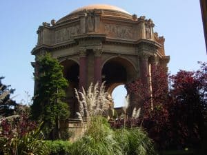 We took some time to enjoy the gardens, the walk around the lake and the beauty of the sculptures and buildings was worth the stop. Photo opportunities comes up around every turn and twist.
The Palace of Fine Arts in the Marina District of San Francisco, California, is a monumental structure originally constructed for the 1915 Panama-Pacific Exposition in order to exhibit works of art presented there. One of only a few surviving structures from the Exposition, it is still situated on its original site. It was rebuilt in 1965, and renovation of the lagoon and walkways (source).
After a few successful cache finds, we were on our way to the Golden Gate Bridge.
Golden Gate Bridge
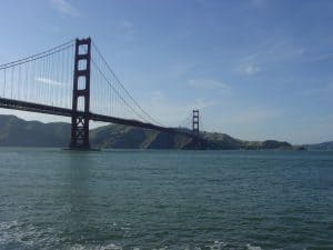 We hiked some more until we came to the Golden Gate Bridge. It was evening and we stopped to look at the bus schedules. We figured we could walk the bridge and then take a bus or cab back.
The Golden Gate Bridge is a suspension bridge spanning the Golden Gate, the one-mile-wide (1.6 km) strait connecting San Francisco Bay and the Pacific Ocean. The structure links the American city of San Francisco, California – the northern tip of the San Francisco Peninsula – to Marin County, carrying both U.S. Route 101 and California State Route 1 across the strait. The bridge is one of the most internationally recognized symbols of San Francisco, California, and the United States. It has been declared one of the Wonders of the Modern World by the American Society of Civil Engineers (source).
We set out across the bridge, stopping to watch the large ships pass underneath. By the time we had green to the other side, the sun had set. We also found no taxi stand or bus stop on the other side. Looking at each other, we decided we would walk back across and catch a bus there. By the time we arrived, the buses had stopped running for the night and there were no taxis to be seen. Well, we had to get back to the hotel somehow, so we continued walking, through the Presidio, through the north shore marina area, turning to go UP Russia Hill and onto Japantown. When we got back to the hotel, we collapsed.
I checked the next morning and according to the GPS, we had walked 33 miles that day.

